
During the Day 4 of my REDAS training last April 16-21, 2018, we were able to conduct a field activity with regards to the use of REDAS EDM or Exposure Database Module on Android. The data gathered will be later on can be used to plot the map of the exposure in which other useful data can then be added.
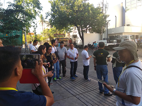
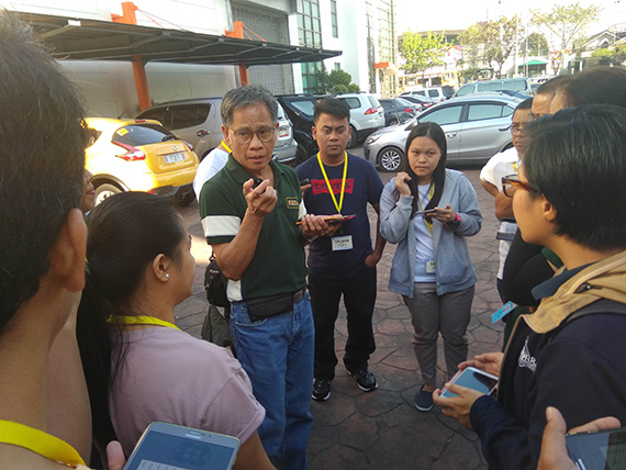
The participants were divided into three teams wherein each group was assigned to survey a specific block and streets that were near the hotel venue. Their task was to use the mobile software to obtain the location of buildings in the area and to identify other relevant details. I was part of Group 1 and the good thing is our area of coverage is just one block radius from the hotel venue. We started with an orientation with the Phivolcs staff on the actual use of the application on the field, firstly on how to estimate building locations.
After a few minutes of discussion, we started the EDM survey. Each participant will need to have three buildings identified. The first building we identified is the hotel that we are staying in, Brentwood Suites. We pointed our devices to the front part of the building and checked the distance from the observer’s location. Take note to set up your default geography first along with setting the pace factor. This is to avoid problems when taking readings during the field work. Once the lat-long location has been recorded, the next step is to use the camera for image capture. The goal is to capture photos of all side of the building but that might not be possible sometimes because of hindrances such as a gate or one side being covered with trees or other buildings. I just decided that time to take picture of an angle of the target building aside from its front photo.
We then walked to the next block while finding the next building to identify. I had a hard time memorizing the type of building according to its code but there is a manual in the app that you can access. I would have it rather on a separate page in my notes. Anyhow, I was able to finish locating and identifying the five buildings after an hour, though each data input should be noted down as there are no indicators in the app that those fields were already done unless you would open it again. I took a break under the shade near the hotel and waited for the other members of the group to be done with their activity. Once the group was complete, we proceeded right away back to the workshop’s conference room to prepare the data we gathered and enter it into the REDAS software.
Here are some pics I’ve taken along with the buildings I have identified using the EDM app.