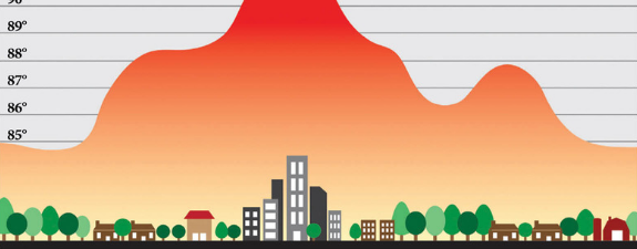
I participated on this second Project GUHEat Planning Workshop and Training weeks after I joined the team of researchers who conducted the temperature data survey in one of the project cities which is Iloilo City. It was two days of scorched experience taking temperatures under the heat of the April sun but valuing those data as the basis for future research and studies. See Exhibit A below.

Going back, this training workshop was conducted last May 9-12, 2019 at the Parkview Hotel in Baguio City (weee, I get to visit Baguio again) and was hosted by the University of the Cordilleras and in partnership with University of the Philippines Training Center for Applied Geodesy and Photogrammetry (UP TCAGP) and funded by the Innovation Council (Philippine Council for Industry, Energy, & Emerging Technology Research & Development of DOST (DOST-PCIEERD)
We arrived Manila the day before at around 4 PM and decided to go directly to the Pasay Bus Terminal to check on the bus schedule going to Baguio City. I suggested that we take the Joy Bus as the features were more comfortable basing on the promo video and some blogger’s suggestion online.
The trip schedule was 6:00 pm and the bus departed at that exact time. There were a few passengers already and we traversed EDSA going to their Cubao Terminal before we start the actual travel to Baguio. It was the worse and grueling travel for me given that we are inside an air-conditioned bus. that is because of the heavy traffic and partnered with the sudden downpour of heavy rain. It took us nearly 3 hours just to get to the Cubao station.
The bus staff provided us free snacks and bottled water along with some blankets for the cold and to make it more comfortable sleeping. The bus then exited to the NLEX and while I was enjoying my music while somewhat laying down to sleep, I took a glance on the bus window to see that it was a long highway with just lights of the vehicles from the other lane and the blinking street lights as we pass through. I guess I just needed to doze off.
We arrived in Baguio city nearing midnight and transferred to a taxi to go to our reserved apartment. Unfortunately, my friend and officemate had reserved the room for the next day and so we needed to rent another one to spend the night. Good thing there are still vacant apartments.
The Training Workshop Proper
We got to the Parkview Hotel the next day in which the first schedule was on that afternoon. There were already a few participants loitering around but the organizers has not arrived just yet.
Checking on the seminar schedule on the document, we are expecting lectures and presentations regarding Project GUHeat’s objectives, plans, and activities and also updates from the first training workshop.
What started was the various demonstrations with the use of data acquisition equipment, one of which was a customized drone and the other looked to be a small plane with a camera. These two are to be used for mapping survey.
On to the second day, the activities were as follows:
- Opening Ceremony (Welcome Remarks and Message by Engr. Nathaniel Vincent Lubrica)
- Summary of the 1st Planning Workshop and Training
- Project GUHeat Field Activities: Summary, General Steps and Techniques
- Updates from each Project Site
- Lectures on:
Temperature Trends in the Philippines: Distinctive Impacts of Urbanization? - Initial UHI of GUHeat Sites
- A Study on UHI in Quezon City
- Other Sources of Thermal Imagery
- Strategies for Mitigation of Urban Heat Island Effects
- Training: Climate Engine, Data Preparation, and Multivariate Linear
- Regression Modelling using GeoDa
- Discussion of Future Activities
At the third and last day of the seminar training workshop, we had the group activity, which was the LST and Air Quality Measurement within Baguio CBD. We were divided in four groups and good thing I was teamed up with Kaye again, our research assistant during the data gathering in Iloilo City last April.
We performed similar pattern with what we did last time and our assignment was on the left side of Burnham Park which was just across the hotel venue. It was definitely easier to get surface temperature data on a cold weather. We finished early so we got the extra time to enjoy the park and I had a taste of the strawberry taho there. It ain’t that impressive but still delicious.
Overall, what I importantly learned is on how relevant the base data are from each of the project cities as this would be later on used for further studies and analysis, not only with the Geoda software but also with other software that Project GUHeat or people from DOST will recommend.
Lastly, here below are the pics I took from training workshop:
